
By Chris Worick, Lumpkin County Historical Society
In the early 1990’s, the City of Dahlonega as well as the Lumpkin County planning commission began to look at locations which could be suitable to create a reservoir to provide drinking water for the growing population. The bottom land in which Yahoola Creek ran through just outside the city limits looked very promising.
The property which was owned by the Zwerner family of Atlanta, was purchased in 1996. In 2001, construction began on the dam which would regulate the water level of Yahoola Creek. Named the “Ted Taft Copeland Dam” in honor of local businessman and land owner Ted Copeland. When the dam was completed in 2003, the reservoir began filling. Dedication of the completed reservoir and the newly named “Lake Zwerner” took place in 2007.
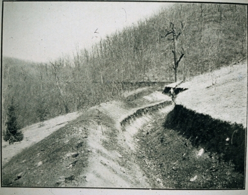
A 3.2 mile long hiking trail loop was created around the reservoir to provide the public with the opportunity to take in some of Lumpkin County’s natural beauty. One of the most interesting features which can be seen along the trail are the remains of old water ditches. These canals or ditches played a crucial part in Dahlonega’s gold mining history and date back to the 19th century.
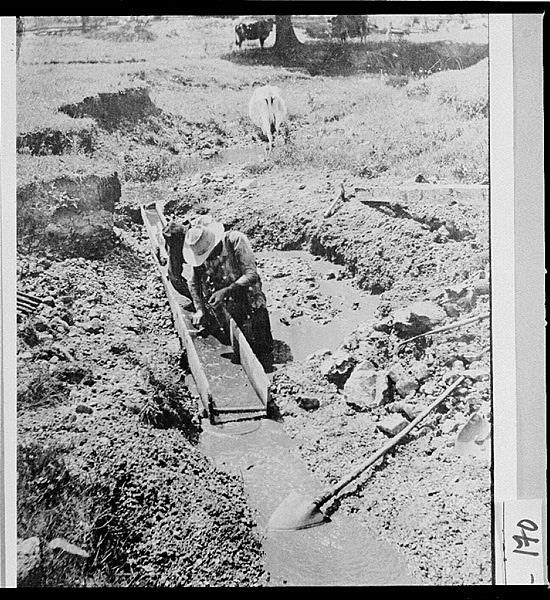
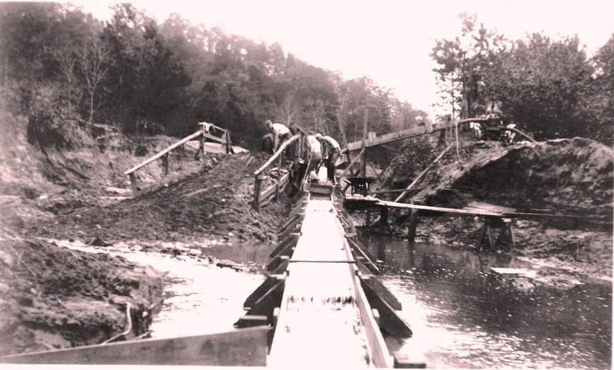
During the Georgia Gold Rush of 1829, miners quickly learned that in order to “wash” the dirt in order to find the gold, more and more water was needed. Wooden “sluice” boxes were created to have the water flow through the long series of connecting boards. The bottom of the sluice would have cleats nailed to the bottom at regular intervals which trapped any gold contained in the dirt as the water flowed out of the sluice.
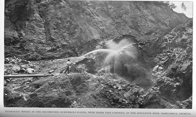
As new, and more sophisticated mining techniques were created, more water was necessary to process larger quantities of dirt. By the late 1850’s a process known as hydraulic mining, was introduced which used large water cannons or “monitors” to blast the dirt away from the hillsides. This would then expose the hidden gold bearing quartz veins on the exposed hills.
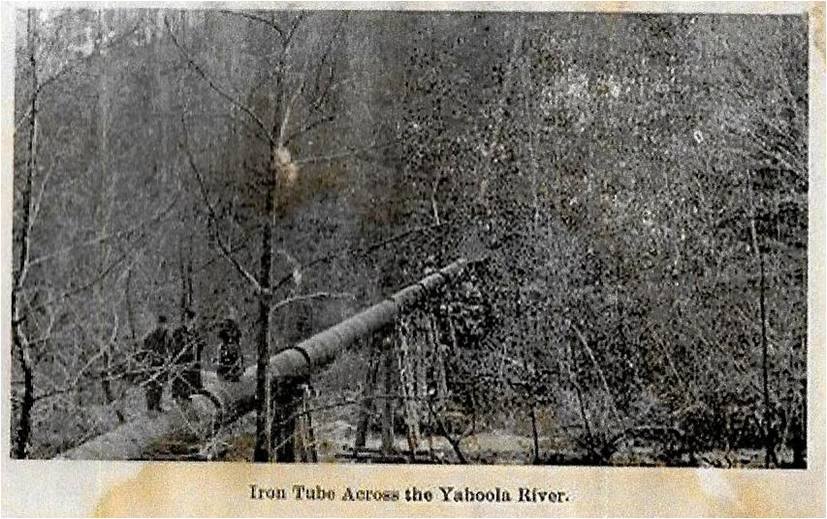
Since much of the hidden gold deposits were not always located near an adequate source of water, engineers constructed a series of interconnected canals, trestles, tubes, aqueducts and ditches. In many cases, streams and creeks, located many miles away were diverted to bring a continuous flow of water to the mines.
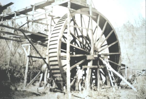
The same concept of diverting water was also used to turn the huge water wheels of the local mills around the county. Pictured are local, Lumpkin County photos which illustrate examples of why water was important to mining as well as mills to operate.